Europe in the medieval times
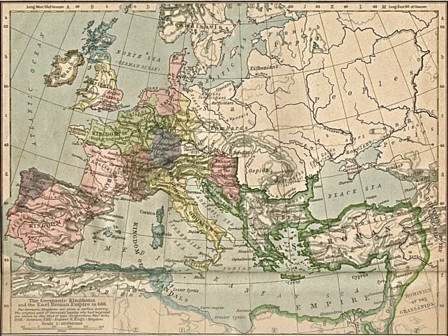
| Europe in 486 – The last Roman Empire |
 |
| Europe in 814 – Charlemagne |
 |
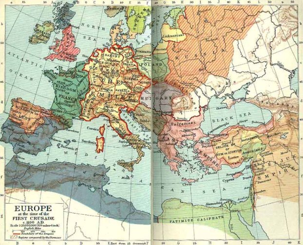
| Europe in 1100 – at the time of the first cruisades |
 |
| Europe in the 13th century |
 |
| Europe in 1560 – Renaissance |
 |
| From l’an 1000 to l’an 2000 |
| 1000 years in couple minutes, when some countries, like France or Spain have been somehow defined pretty early, others like Germany or Italy had to wait until the Eighteenth century to exist as we know them today. |
| http://vimeo.com/89394659 |
| https://www.youtube.com/watch?v=uQf-PZWFMzY |
Watch as 1000 years of European borders change (timelapse map)
An incredible timelapse look at how drastically European borders have changed over the last 1000 years
CENTENNIA is a map-based guide to the history of Europe and the Middle East from the beginning of the 11th century to the present. It is a dynamic, animated historical atlas including over 9,000 border changes. The map controls evolve the map forward or backward in time bringing the static map to life. Our maps display every major war and territorial conflict displaying the status of each region at intervals of a tenth of a year. The maps reflect actual “power on the ground” rather than internationally-sanctioned or “recognized” borders.
From the “Centennia Historical Atlas”… created and developed by Centennia Software, Conanicut Island USA. Frank E. Reed, software developer and cartographer. All rights reserved. Please note that the copyright to all maps and animations in the “Centennia Historical Atlas” are held by Centennia Software.
Any other videos containing our maps are direct copyright violations.
Sources : Historicalatlas.com

Leave a comment